![]()
|
|
|
|
|
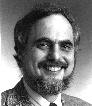
OriginsThe geoinformation era began modestly in the early 1960's with the first computer assisted drafting and mapping systems, and for more than a decade evolved in close connection with advances computer graphic technology. The term geographic information system (GIS) was coined in Canada in 1962 to describe a prototype provincial land information system, and has come to characterize the field that subsequently emerged. Firms such as ESRI and Intergraph were founded in this early period, soon to be followed by a host of related enterprises such as ERDAS, Geographic Data Technology, ETAK and MapInfo. Much early R&D in GIS was supported or conducted by civilian and military government agencies, leading to data structure innovations such as DIME Files, Chain Files, Digital Line Graphs and Digital Elevation Models. These and other developments were discussed at the first international symposium on computer-assisted cartography (Auto-Carto) in 1971, a series that continued to be held biannually until 1997. Now the field is increasingly diverse, and known not only as GIS, but also as Geoinformation, Geoprocessing, Geomatics, Spatial Information Science, Spatial Data Handling and numerous sub-specialties. Our root connection to these developments, and that of many other GIS innovators, was through the Laboratory for Computer Graphics and Spatial Analysis, housed in Harvard's Graduate School of Design from 1965 to 1986. This was the first and foremost university lab to develop digital mapping and GIS technology. Its influence was felt through distribution of low-cost software, technical reports and cartographic databases to users and researchers around the world from 1965 onward. Through correspondence courses, conferences, symposia and seminars, the Harvard Lab educated and influenced many people, and over twenty years employed more than 130 individuals, many of whom went forth to contribute to the field in a variety of significant capacities. Dr. Geoffrey Dutton, founder of Spatial Effects, served as a researcher in the Harvard Lab from 1968 through 1984, witnessing and contributing to technical developments during its heyday. Educated in City and Regional Planning at Harvard, he turned his attention to geoprocessing and cartography in the 1970's, working on application projects and contract research. He was also responsible for preparing reports and articles, maps for publication and editing user manuals, newsletters and technical proceedings, including Harvard Papers on Geographic Information Systems, an eight-volume set published in 1979 by Addison-Wesley. The work increasingly involved in programming proofs of a variety of cartographic and spatial analytic concepts, mostly in Fortran, first in batch mode on IBM mainframes, then interactively on DEC timeshared minicomputer systems. Areas investigated included Location-Allocation Modeling, Digital Terrain Modeling and Data Compression, Color Hillshading, Multi-variate Thematic Mapping, Contouring and Shading Algorithms, Map Animation, Fractal Enhancement of Vector Map Data, Calligraphic Text Display and Tutorial Systems for Teaching Computer Graphics. One unheralded development was the Artist program, an interactive, object-oriented, direct-manipulation drawing application for producing diagrams and creative designs written in Fortran for a Tektronix storage-tube display; eight years later Apple released MacDraw, and everyone could now do this. Many of these projects are described and illustrated elsewhere Recognizing that GIS had entered a new phase of commercial application, Spatial Effects was launched in 1984 to provide consulting services to organizations seeking expertise and guidance in applying computer graphics and geospatial technologies to problems in their domains. Some of these projects, undertaken for nonprofit, governmental and commercial clients, are described elsewhere in these pages. While working as a consultant, he continued research and writing in geoprocessing, maintaining links to academia, particularly through participating in four research initiatives of the National Center for Geographic Information and Analysis (NCGIA). In 1992, NCGIA recognized his contributions by receiving him a visiting scholar. Consulting activites between 1996 and 1998 were curtailed, due to an appointment to research and write a Ph.D. dissertation at the Department of Geography, University of Zürich. That degree was awarded in 1998, for "A Hierarchical Coordinate System for Geoprocessing and Cartography," published later that year by Springer-Verlag. After a year of post-doctoral research in agent-based map generalization in Zürich, Geoff returned to the U.S. to continue working in the field.
What We DoSpatial Effects will help you make sense out of spatial data. Whether you need to frame a problem, consider a solution, analyze your information or communicate your conclusions, if it involves thinking spatially or communicating graphically there's a good chance we can help you do it better. You can evaluate this claim for yourself; see examples in our project archive, our research pages, and a paper on Visualizing Map Generalization Solutions on the World Wide Web. Our expertise is focused on solving problems in graphic or spatial contexts. We strive to consider not only the graphic appearance of spatial data, but also its quality, intended use and underlying meaning. This often requires consideration of spatial relations inherent or implied in datasets and applications. It is our view, for example, that many problems in map generalization cannot be successfully solved without paying attention to the semantic content of map data, and therefore of the geographic phenomena they represent and the symbols used to present them. As a result of hard experience in geoprocessing technology, we have learned to be wary of perennial impediments to solutions; we understand what problems are amenable to a brute force and what ones may be deeper and less tractable. GIS applications are prone to break when they are scaled up, or applied to different data than originally anticipated. Sometimes users don't even realize that something is wrong -- results may appear to be reasonable but are nonetheless riddled with errors. We can help by designing data-handling approaches that are error-sensitive and in some cases error-correcting, making strategic use of metadata, and by analyzing existing application data, results and code to spot potential bugs and anomalies. We also work with clients to develop new applications and enhance existing ones. While we sometimes end up writing code, we normally limit such work to helping clients articulate their desires and requirements, surveying existing platforms and toolkits for cost-effective solutions, and generating functional specifications to supply software vendors and contractors. If desired, we work on-site to monitor the progress of implementation, and help prepare and analyze benchmarks and other performance criteria to stress-test individual modules and overall systems. We document our work verbally and graphically, and preferably interactively. New systems, applications and toolkits appear daily, along with new sources of geospatial information and expertise. Most of this activity is available on the Internet, and we are constantly searching the net for innovations that may prove useful to clients. As time goes on, geoprocessing standards will be ironed out that allow more of these developments to interoperate. We see a new model of geoprocessing emerging, one that is colleagial, distributed, and much more customizable than traditional shrinkwrapped solutions are able to be. Spatial Effects has been and will remain in the vanguard of this global revolution of cooperative, distributed geoprocessing. Because geoprocessing has grown so quickly, at a still-accelerating pace, nobody can possibly be on top of every important new development. While conferences and expos remain important avenues for exchanging new ideas and technology, the world-wide web is an indispensible medium for sharing knowledge, software and data. That's why we sponsor discussion groups and link to still more, and encourage everyone who is concerned with geoprocessing to form communities of interest for mutual support and advancement.
What We Don't Do
Selected Clients
|